
Digital Earth Africa Wetland Tool Kit (English)


Digital Earth Africa
Enrollment is Closed

Register or sign in to enrol in this course.

About This Course

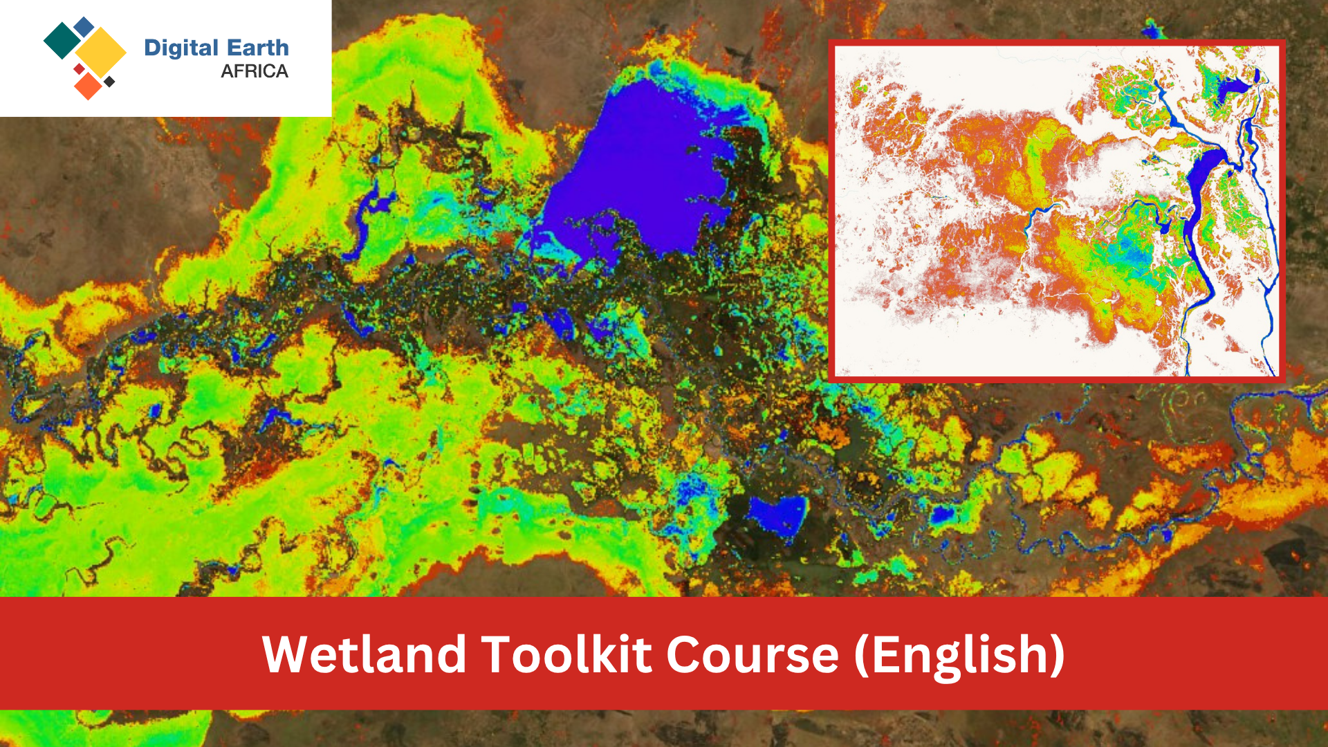
Welcome to the Wetland Toolkit Course, where you’ll learn to harness Digital Earth Africa’s open-source EO tools and data to map, classify and monitor wetlands across Africa. Wetlands deliver vital ecosystem services—water purification, flood regulation, carbon storage and biodiversity support—yet are rapidly disappearing due to drainage, agriculture and climate change. By the end of this course you will be able to use DE Africa’s Water Observations from Space (WOfS), Wetlands Insight Tool (WIT), Open Data Cube machine-learning workflows, and spectral indices (NDWI, NDVI, NDTI) to delineate wetland extent, classify wetland types, monitor seasonal and long-term dynamics, and support SDG 6.6.1 reporting.

Course Objectives

  • Delineate wetland extent and intrinsic potential using optical (Sentinel-2, Landsat) and radar data.
  • Classify wetlands by vegetation cover (open water vs vegetated; non-vegetated, herbaceous, forested) and detect converted areas (urban, cropland) following FAO LCCS principles.
  • Compute and visualise time-series indicators: water clarity (NDTI), vegetation health (NDVI & anomalies), inundation frequency (WOfS) and fractional cover (WIT).
  • Support SDG 6.6.1 reporting by quantifying changes in wetland extent and condition over time.
  • Explain key wetland ecosystem services and threats, interpret data gaps (e.g. cloud cover) and compile results into concise reports and visualisations.

Course Structure

  1. Session 1: Wetland Delineation & Classification
    Part A: Supervised machine-learning on the ODC to map intrinsic wetland potential using Sentinel-2, radar and elevation data.
    Part B: Basic classification into vegetation vs converted classes (optical, radar, cropland/urban).
  2. Session 2: EO Indicators & Wetland Types
    Compute NDTI for water clarity (Landsat & WOfS mask).
    Use WIT and WOfS to plot seasonal inundation and vegetation fractions.
    Analyse NDVI anomalies for wetland health and apply them to the DE Africa Waterbodies dataset.
  3. Session 3: Vegetated Wetlands & Mangroves
    Map and monitor mangrove ecosystems using the Global Mangrove Watch baseline.
    Apply NDVI and NDWI to assess mangrove extent and health over time.

Key Monitoring Components

  • Water Observations from Space (WOfS): Landsat-derived maps of historical surface water—seasonality, long-term trends and perennial vs seasonal wetlands.
  • Wetlands Insight Tool (WIT): Interactive notebook combining fractional cover, WOfS detections and other datasets into stacked-area plots of wetland composition.
  • Landsat Analysis Ready Data (ARD): Harmonised 30-year archive of surface-reflectance imagery underpinning DE Africa products and custom indices.
  • Vegetation & Water Indices: NDVI for vegetation ‘greenness’; NDWI for open water—analysed to reveal flooding patterns and phenology.
  • Global Mangrove Watch (GMW): Pan-Africa baseline of mangrove extent (1996–2016) for canopy classification, tidal adjustment and coastal wetland change detection.

All exercises run in DE Africa’s cloud-based Sandbox using Python in Jupyter notebooks, with example code you can adapt for your own study areas. Learners are encouraged to view DE Africa live sessions on YouTube and consult the DE Africa User Guide.

Content developed by Kartoza (pty) Ltd.

Course Staff

Profile picture of Kenneth Mubea

Kenneth Mubea, PhD

Capacity Development Lead

Kenneth provides technical assistance, user engagement and support, driving adoption of DE Africa services and collaborating with partners across Africa.

Profile picture of Joseph Tuyishimire

Joseph Tuyishimire

User Engagement Manager

Joseph leads capacity-building, technical support, and co-developing wetland mapping use cases with individuals and institutions across Africa.

Frequently Asked Questions

How can I view course content without registering?

All course content is freely viewable on the course homepage. Registration is required to complete quizzes and earn certification.

What web browser should I use?

DE Africa Learning works best with current versions of Chrome, Edge, Firefox, or Safari.

See the supported browsers list for details.