
Digital Earth Africa Climate Action Tool Kit (English)


Digital Earth Africa
Enrollment is Closed

Register or sign in to enrol in this course.

About This Course

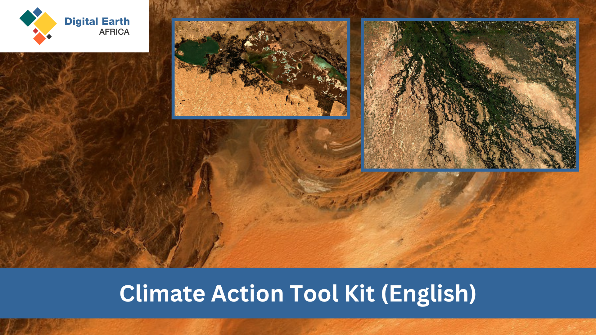
Welcome to the Climate Action Toolkit Course using Digital Earth Africa (DE Africa)! This course will equip you with the skills to harness open, analysis-ready satellite data—Landsat, Sentinel and derived products (e.g. forest cover, water extent, soil moisture)—for tracking greenhouse gas sinks/sources and assessing climate impacts across Africa.

Course Objectives

  • Select and use DE Africa climate products: Identify and load key EO datasets (Fractional Cover, Water Observations from Space, ERA5) for mitigation and adaptation analyses.
  • Map and quantify land-cover changes: Detect deforestation and reforestation trends and estimate associated carbon emissions.
  • Analyse water and drought indicators: Delineate flood extents using SAR and evaluate drought conditions via NDVI/TVDI and climate data.
  • Apply custom multi-source workflows: Integrate NDVI/phenology, soil moisture, and water extent products into bespoke assessment pipelines.
  • Support climate reporting and MRV: Build time-series trends and anomaly analyses that align with NDC and SDG monitoring requirements.

Course Structure

  1. Session 1: Land Cover & Carbon (Deforestation/Reforestation) – Mapping forest loss and gain in the Congo Basin (2015–2020).
  2. Session 2: Forest Carbon & Coastal Mangroves – Quantifying carbon stocks and mapping mangrove extent in West Africa.
  3. Session 3: Flood Risk Assessment – Flood inundation mapping in the Niger River floodplain and impact analysis.
  4. Session 4: Drought, Agriculture & Coastal Erosion – Monitoring agricultural drought in East Africa and shoreline change in KZN, South Africa.

Key Monitoring Components

  • DE Africa Fractional Cover (vegetation cover and biomass proxies)
  • Water Observations from Space (historical water-occurrence maps)
  • ERA5 Climate Data (precipitation and soil-moisture layers)
  • NDVI & Phenology Products (time-series anomaly detection)
  • Coastlines Monitoring (20-year shoreline change detection)

This is a self-paced learning course and learners will be able to use DE Africa’s monitoring services, which leverage over three decades of Water Observations from Space products within the HydroSHEDS v1.1 Land Mask. Learners are encouraged to view DE Africa live sessions on YouTube and consult the DE Africa User Guide.

Content developed by Kartoza (Pty) Ltd.

Course Staff

Profile picture of Kenneth Mubea

Kenneth Mubea, PhD

Capacity Development Lead

Kenneth provides technical assistance, user engagement and support, driving adoption of DE Africa services and collaborating with partners across Africa.

Profile picture of Joseph Tuyishimire

Joseph Tuyishimire

User Engagement Manager

Joseph leads capacity-building, technical support, and co-developing use cases with individuals and institutions across Africa.

Frequently Asked Questions

How can I view course content without registering?

All course content is freely viewable on the course homepage. Registration is required to complete quizzes and earn certification.

What web browser should I use?

DE Africa Learning works best with current versions of Chrome, Edge, Firefox, or Safari.

See the supported browsers list for details.